
Road map for the detection of deforestation
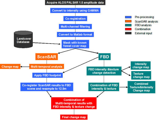
Note that change maps can be obtained at intermediate stages before the final result. In fact the FBD combined intensity and texture analysis delivers results almost up to the standard of the full analysis and is relatively straightforward since it requires only 2 images. The ScanSAR analysis, by itself, is a little more time consuming since several images are required. The combination of ScanSAR and FBD leads to small improvements that must be balanced against the difficulty of matching up the two types of data.